To the Shikra of Kanha, the mechanical silhouette arriving over the field almost qualifies as a bird. Four stiff legs hang beneath it like talons that never learned to close, and its wide arms beat the air where wings should bend, emitting a hard, breathless whir. Beneath its belly, a red-green light blinks like an eye that refuses to look back.
From the Mahua branch, the Shikra lifts, circles once, and dives in a warning pass—a question written in wind—but the intruder neither chases nor flees. It only stares at the crops as if the earth matters more than the sky. The Shikra calls again, sharper now, before veering away in irritation. It leaves behind the creature with wings, but no manners – The Earth Focus drone.
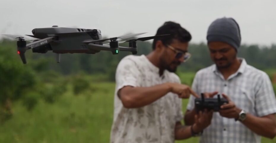
The View from Above
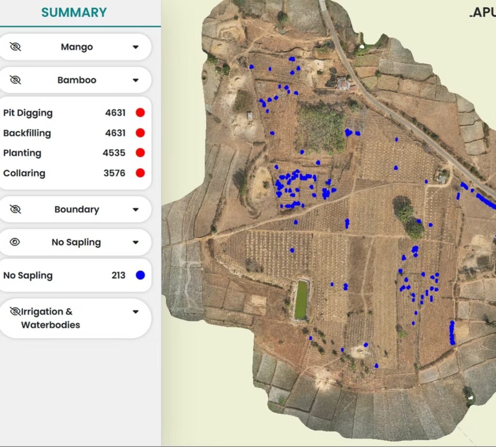
The drone, acquired through a partnership with Qualcomm, takes flight just after sunrise—not as a daily watcher, but as a periodic visitor. It rises once every month, or when planting completes and plantations need review. Its task is precise: to verify if what was planned on paper has taken root on land, and how it is shaping up.
In a single flight, it traces nearly 60 acres of clustered farmland: young mango trees in careful rows, bamboo along boundaries, and intercropped beds of millet and turmeric stitched into red earth. What looks continuous from the ground separates into distinct patterns from the air.
This is not the familiar image of a tribal childhood… Nor is it a performance of technology placed over poverty. It is applied intelligence.
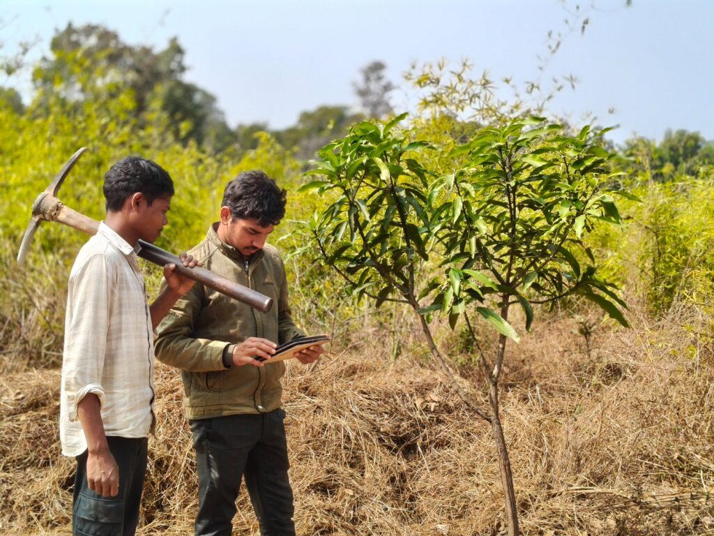
On the console screen below, while healthy patches hold their colour, one corner shifts tone. The system flags it. By noon, the alert reaches the cluster coordinator. By afternoon, three people are walking toward that patch: one to check the drip line, one to feel the soil, and one to read the discoloured leaves.
Data-Driven Stewardship
In this instance, the team finds two problems. In one row, an irrigation pipe has twisted under the sun, starving the roots. In another, ants have begun nesting near the collar of a sapling already weakened by heat stress. The pipe is reset. The base is treated. One sapling is replaced. Nothing dramatic occurs, yet a measurable loss is prevented.
Here, technology sharpens local knowledge. Response begins before damage becomes visible. Earlier, loss appeared only at harvest; now it appears as data while recovery is still possible.
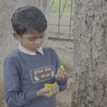
On weekends, the drone gathers an audience. Children run along the fence lines when it rises, following its shadow across the plots. They know which mango trees belong to which family. When elders walk out to repair a pipe or replace a sapling, the children follow. They are growing up between the forest and the system, learning to read both cloud and code.
An Operating System for Land
Across the programme, every land parcel is geotagged and given a digital profile. Every sapling planted—bamboo, mango, native tree—is logged with its planting date, spacing, and survival status. Field data is gathered by trained community mobilisers using digital survey tools (ODK) and fed into live patch sheets.
In the last 4 years, out of the nearly 800 acres under restoration, about 185 acres now hold mango plantations. Bamboo lines the remaining fields and boundaries, stabilising soil and marking plots. Between and beyond these tree systems lie patches of seasonal crops—millets, oilseeds, and turmeric. What was once a barren landscape is now layered in time and depth: trees that wait for years, crops that mature in months, and soil that is never left bare.
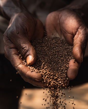
The Return of Millets
Among the seasonal crops, Kutki and Kodo millets are grown in alternating years. The rotation enriches the soil not through nitrogen fixation, but through variation: different roots, different residues, different demands. Pests lose their rhythm, and moisture lasts longer.
Once dismissed as “poor man’s grain,” millet now returns as something closer to medicine. Among elders, it is spoken of as food for strength and diabetes control. Though rice still dominates everyday meals, millets appear as treats and tonics: kheer for children, laddoos during festivals, and pessi—a thin soup—given when someone falls ill.
Water and Soil
Water governs everything here. These fields were once entirely barren, devoid of top soil, and grew nothing. Today, irrigation moves in narrow lines. Drip systems serve the mango plantations, delivering water directly to the roots, while sprinklers support the bamboo stands. The shift is structural: water becomes scheduled rather than awaited.
At the heart of the programme lies a commitment to nature-based solutions. Chemical fertilisers are avoided. Instead, fields are treated with Jeevamrit: a fermented bio-inoculant made from cow dung, cow urine, jaggery, besan, local soil, and water. Applied to the base of plants, it feeds microbial life, rebuilding fertility through living processes rather than external inputs. Instead of being forced into productivity, the soil is coached back into function.
The Impact
For those who believe that ecological restoration must be as rigorous as any supply chain, this is the result. This is how a landscape of almost 800 acres of agroforestry is managed, all of it in 4 years :
- 30 million INR in public scheme incentives unlocked and routed into land restoration
- 300,000 saplings are now under tracked survival cycles
- Over 250 families cultivate through this systems
- 80% minimum survival rate maintained in a terrain where heatwaves, erratic rain, and grazing pressure make even 50% survival rate difficult
What has been built is not only farms, but an operating system for land. Every plot is mapped. Loss is anticipated. Replacement planting is planned in cycles. It is an invitation to invest in a system where tribal stewardship meets spatial mapping, and where precision is not a machine but a relationship—between soil, system, and the people who stand between them.